The Dangerous Path of Major Hurricane Beryl
By Circles Robinson
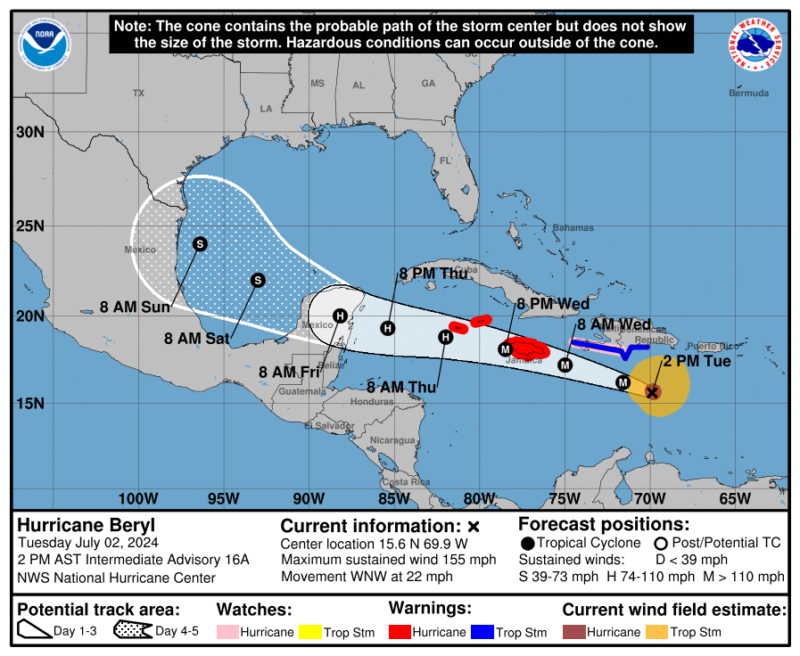
HAVANA TIMES – Category 5 Hurricane Beryl is moving swiftly in the central Caribbean Sea en route to a probable encounter on Wednesday with Jamaica and Thursday with the Cayman Islands. The storm is considered life-threatening and prone to major damage.
As of 2:00 PM EST on Tuesday the storm packs highly destructive 155 mph (250 kph) winds. It is moving west-northwest at the rapid speed of 22 mph (35 kph).
Hurricane-force winds extend outward up to 40 miles (65 km) from the center and tropical-storm-force winds extend outward up to 175 miles (280 km), notes the National Hurricane Center based in Miami.
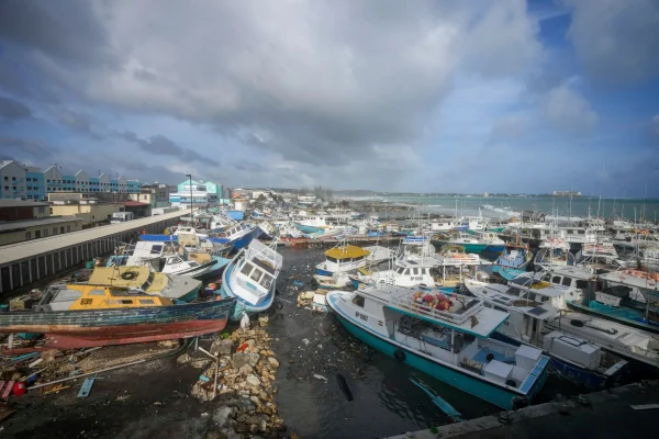
Beryl caused considerable damage on Monday in the Caribbean Islands of Grenada and St. Vincent and the Grenadines.
The National Hurricane Center further notes that “Beryl is expected to produce rainfall totals of 4 to 8 inches, with localized maxima of 12 inches, across Jamaica and the southwestern Haitian Peninsula through late Wednesday. Beryl will also produce rainfall amounts of 4 to 8 inches with isolated amounts of 10 inches across the Barahona Peninsula in southwest Dominican Republic. Isolated totals of 6 inches or more are also anticipated across the mountainous terrain in the central Dominican Republic. This rainfall is likely to cause flash flooding and mudslides.”
At this time a Hurricane Warning is in effect for Jamaica and the Cayman Islands. A Hurricane Watch is in effect for the south coast of Haiti and the Dominican Republic.
In Cuba, weather experts and civil defense authorities stated this morning that due to the evolution and future trajectory of Hurricane Beryl, close monitoring of this tropical cyclonic organism is maintained.