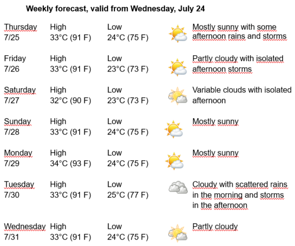
Havana Weather for July 25 – 31

Warm Days with Isolated Afternoon Storms
By Adrian Fuentes
HAVANA TIMES – The influence of oceanic high pressures continues over Cuba, with its center located in the central Atlantic Ocean, imposing weak pressure gradients with light variable winds. Additionally, at altitudes between 9 to 12 kilometers, there is the influence of upper-level lows, one to the northeast of the eastern half of Cuba and the other in the western Caribbean Sea. The latter will favor the occurrence of showers, rain, and thunderstorms in the western region, mainly inland and south, while they will be isolated in the rest of the country.
Over the next few days, most of the capital will experience mornings with little cloud cover, except in northern coastal areas where it will be partially cloudy with isolated showers. By late morning, it will be partly cloudy and will become cloudier in the afternoon towards inland localities with some showers, rain, and thunderstorms. Winds will be from the northeast to east at speeds between 10 and 25 kilometers per hour. Relative humidity will range from 70% to 90%. High temperatures will range between 32 and 34ºC (90 and 93 F) and lows between 23 and 25ºC (73 and 77 F). The sea surface temperature will be 29ºC (84 F).
In the Atlantic Ocean, Caribbean Sea, and Gulf of Mexico, no tropical cyclonic development is expected in the next 12 to 24 hours.