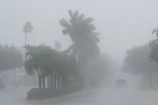
Climate Change Behind Lethal Force of Helene and Milton

Marta Lavandier/AP
Millions were seeking shelter in anticipation of strong winds and rainfall. Like its predecessor Helene, this hurricane has been strengthened by waters warmed by climate change.
HAVANA TIMES – Hurricane Milton, is currently advancing dangerously towards the Florida peninsula in the southeastern United States, Like its predecessor Helene, its winds have been strengthened by the increased heat caused by climate change, according to the World Meteorological Organization (WMO).
A WMO bulletin noted: “Ocean heat in the Gulf of Mexico plays an important role, as warm sea surface temperatures provide the energy needed for hurricanes to intensify.”
“The deeper down the warm waters reach, the more energy a storm can absorb,” the entity explained.
Milton, which quickly reached category 5 – the highest on the Saffir-Simpson scale – was downgraded to level 4 on Tuesday, October 8, but was still advancing over the Gulf of Mexico then tonight reaching the central Florida coast with wind speeds of 195 kilometers (120 miles) per hour.”
Although the eye of the hurricane did not touch the Yucatan Peninsula in southeastern Mexico, its tails was felt there in the form of heavy rains and oceanic storm surges several meters high. Authorities in the region declared a state of alert.
In Tampa and other cities in west-central Florida, a massive stampede congested the highways after authorities instructed millions of people to leave, board up their homes and businesses and seek refuge in the southern tip of the peninsula, or in cities to the north of it.
The US National Hurricane Center declared a maximum alert for the coastal region, indicating that Milton “will remain an extremely dangerous hurricane when it reaches Florida on Wednesday night, October 9.” They didn’t rule out the possibility that the storm could regain strength and return to category 5.
A large area of destructive storm surge is foreseen for up to 80 miles along Florida’s west coast on Wednesday, the 9th.
Ron DeSantis, governor of the state of Florida, warned residents along the west coast to prepare for “a fierce storm.” At the same time, DeSantis has denied the existence of climate change.
Rainfall of 5 – 10 inches is expected in parts of the peninsula through Thursday. Such precipitation carries the risk of sudden flooding along urban and surface areas, along with moderate to significant flooding from overflowing riverbanks.
The southeastern United States has still not recovered from Hurricane Helene, which struck the region less than two weeks ago, killing at least 230 people and causing flooding and extensive property damage.
Helene “was extremely anomalous, since it caused its most severe impacts long after making landfall, producing unprecedented flooding,” said Flavio Pons, of the French Pierre-Simon Laplace Institute, dedicated to research in atmospheric and oceanic sciences.
“It is likely that precipitation was enhanced by global warming. In particular, the exceptionally warm waters present in the Gulf of Mexico likely drove both the rapid intensification of Helene and the atmospheric river that ultimately triggered the historic precipitation,” Pons stated.
Citing sources at the US National Oceanic and Atmospheric Administration (Noaa), the WMO said that in the case of Milton “while fluctuations in intensity are expected, it is forecast to remain an extremely dangerous hurricane right up until landfall in Florida.”
Milton intensified at an explosive rate, an increasingly common occurrence, as seen with Hurricane Beryl in July. It was the third fastest intensification in the Atlantic basin.
Milton is expected to cross the Florida peninsula and exit into the Atlantic Ocean on Thursday.
There are currently three active hurricanes in the Atlantic: Milton, Leslie and Kirk. This is considered exceptional for the month of October. Kirk is currently a Level 1 hurricane but is expected to weaken and become a tropical storm as it churns its way across the Atlantic basin towards Europe.
The principal impact of Kirk will be in France. Meteo-Fance predicts that Kirk will be a dangerous storm with wind gusts up to 68 miles per hour on the coast and up to 56 mph inland, plus strong rains from the Loire region to Lorena, including the area around Paris.
First published in Spanish by IPS and translated into English and posted by Havana Times.


