Cuba Safe, TS Karen Heads for Gulf Coast
HAVANA TIMES — Tropical Storm Karen lost a bit of strength on Friday but is still posing a dangerous sea surge threat to large portions of the US Gulf Coast from Louisiana to the Florida Panhandle.
The storm did not bring much rain to western Cuba as had been stated as a possibility.
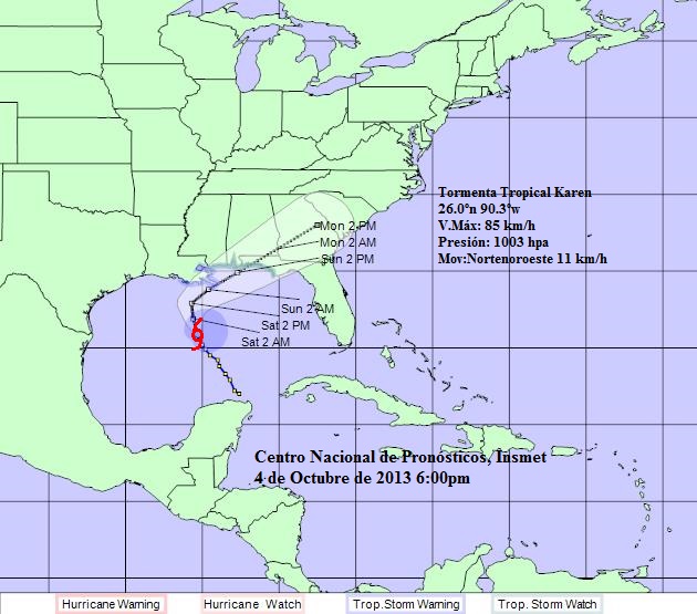
At 6:00 p.m. EST, Karen was packing 50 M/ph (85 K/ph) maximum sustained winds and the center of the storm was located by the Cuban Weather Service (INSMET) at 277 miles (445 kilometers) south of New Orleans and moving north at 7 M/ph (11 K/ph).
During the next 24 to 48 hours Karen is expected to move first to the north, slowing down its movement, and then inclining to the northeast on Sunday with the possibility of gaining intensity before a landing on the northwest Florida Gulf Coast.
A tropical storm warning is in effect for Morgan City Louisiana to the Mouth of the Pearl River, reports the National Hurricane Center (NHC) in Miami. A tropical storm watch is in effect for Metropolitan New Orleans, Lake Maurepas, Lake Pontchartrain and East of the Mouth of the Pearl River to Indian Pass, Florida.
A tropical storm warning means that tropical storm conditions are expected somewhere within the warning area within 36 hours. A tropical storm watch means that tropical storm conditions are possible within the watch area…generally within 48 hours, notes the NHC.