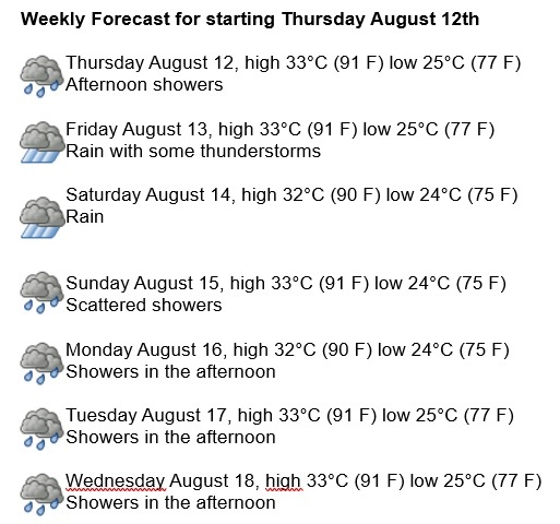
Havana Weather for August 12-18
Tropical depression advances along the north coast of Cuba

By Yanet Díaz
HAVANA TIMES – Tropical depression Fred is located north of eastern Cuba, moving west-northwest at 23 km/h. Its minimum central pressure is 1013 hPa and its maximum sustained winds are 56 km/h with gusts of 75 km/h. So far, deep convection with scattered rains and storms has been recorded in the eastern part of the tropical depression, as well as waves of up to 2 meters on the north coast of Cuba due to this system.
Due to its current forecast path, it is unlikely that Fred will seriously affect western Cuba, but in the east and center some tropical storm conditions may occur during later Thursday and Friday, which will gradually decrease towards the weekend as Fred goes off to Florida. Although strong winds are not expected in Havana, isolated rains and storms will be occurring due to the proximity of this tropical system.
The days will be partially cloudy and with favorable conditions for rains, which will be mostly intermittent throughout the week. Winds will predominate from the northeast with speeds between 20 and 30 km/h with some higher gusts, causing moderate swells on the north coast. Humidity will remain high, with maximums between 90 and 95%. The high temperatures will be at 32 and 33° C (90 and 91 F), and the lows at 24 and 25° C (75 and 77 F). The sea surface temperature will reach 30° C (86 F).
Over the North Atlantic, the Gulf of Mexico and the Caribbean Sea the probability of tropical cyclone development will be high for the next 5 days.
And behind Fred is Grace on the same path but stronger and more rain.