Five Places in Cuba Seen from Space over 37 Years
By Alberto C. Toppin (El Toque)
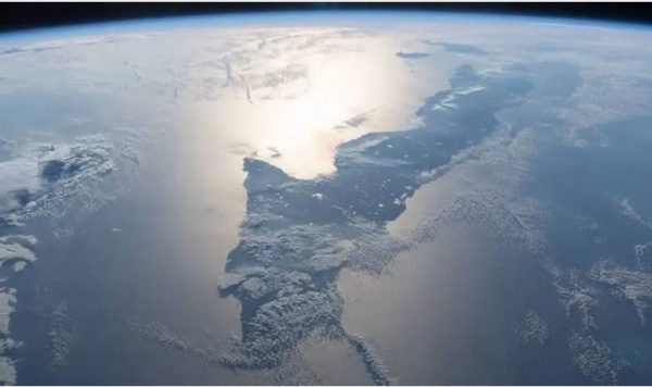
HAVANA TIMES – In mid-April, Google updated one of its most interesting tools: Earth Engine’s Timelapse. It’s a catalog of satellite photos taken every year by organizations such as NASA and the US Geological Survey, from 1984 up until 2020.
The project was born 5 years ago, but it was only in 2021 that it was incorporated into other Google apps, and that it became available to all Google search users.
Looking at the photos that span 37 years, notable changes can be seen in the topography in some places in Cuba. Here is a selection of these places.
1. Mariel
Ever since the 1940s, the Mariel port has been one of the most important in Cuba. However, the most important efforts to reactivate it came after 2014. This year, satellite images show building developments around the bay that constructed what is now known as the Mariel Special Development Zone, which spans over 465 km2.
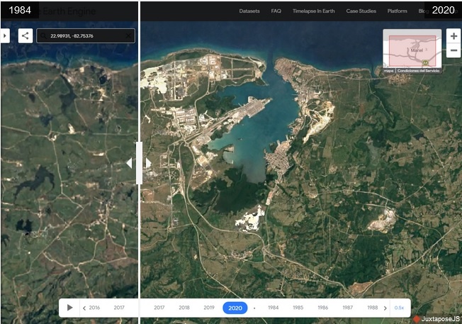
Only 55 businesses have been approved ever since it was officially inaugurated in 2013 and up until today, according to the project’s official website. In early 2020, only 27 of them were operating in the area, according to news reports.
2. Juraguá
One of the Fidel Castro Government’s most iconic projects was the construction of the nuclear power plant in Juragua, in the 1980s. They hoped to produce between 15%-25% of the electricity Cuba needed with this plant, thereby reducing the country’s dependency on Soviet oil imports that came via sea.
According to a BBC report, works on the first reactor began in 1982, and it was the only one to be completed before Fidel Castro ordered works to be suspended in 1992. Cuba saw itself enter its most serious economic crisis in the 1990s and, according to the president at the time, financial budgets to finish the plant and get it up and running had changed. Furthermore, some technical decisions about the plant’s operations had been delayed, after the Chernobyl disaster in 1986.
In 2000, the project to generate electricity with nuclear energy was scrapped. By that time, over 1.1 billion dollars had been invested in building the power plant and another 134 million had been spent on maintaining equipment.
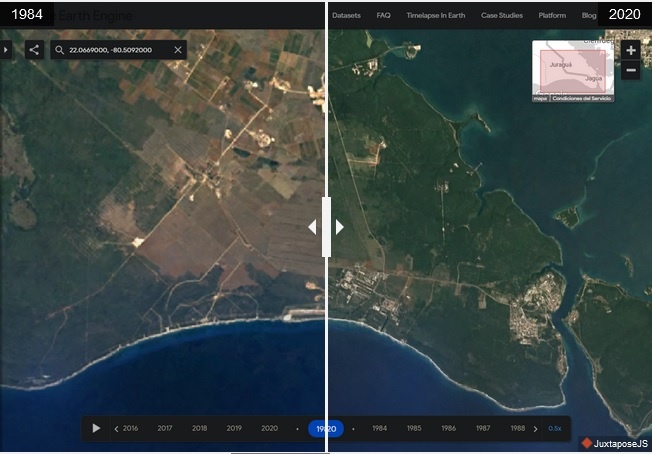
From the satellite images, you can see the construction and operations of channels where sea water would travel down to cool down the reactors.
3. Varadero
While housing development projects in Varadero increased ever since the 1920s – especially by the well-to-do -, but it wasn’t until the 1990s that this sea resort, located on the Hicacos Peninsula, began to see a drastic change in its urban planning.
The crisis that immediately ensued in the wake of the Soviet Union’s collapse, the loss of markets and bilateral agreements pushed the Cuban government to open up to foreign capital, especially in the tourism sector. Dozens of hotels were built on what has been considered one of the best beaches in the world, which is about to reach tens of thousands of rooms in capacity, alongside businesses and other attractions.

The COVID-19 pandemic that has swept the planet has hit tourism particularly hard. Over the past few months, Varadero has remained practically empty compared to similar periods in previous years. However, visitors are beginning to arrive in the area, mostly from Russia.
4. Cayo Santa María
Transforming Cayo Santa María into a tourist area coincided with the so-called Special Period too. Even though it wasn’t developed as heavily as Varadero, you can see significant building developments in this coastal area via the satellite images.
However, the thing that really stands out is main communication channel in this area, which can be seen in Earth Engine’s Timelapse photos. This is the Caibarien – Cayo Santa Maria causeway, which officially began works in December 1989.
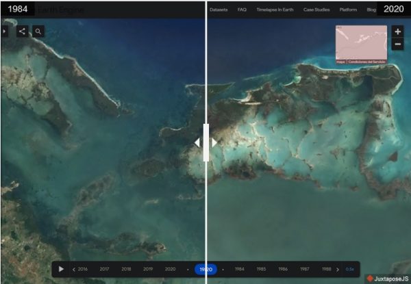
This highway was completed in 1999. In 2001, it received the International Alcantara Bridge Award for the best Ibero-American civil engineering project, as it stood 48 kms long crossing the sea and stands in an area of unique beauty and environmental importance. It is made up of 46 bridges.
5. Moa
In Moa, you can see the impact of human activity in Cuba over the past 37 years. An open-pit mining site, the land where nickel and cobalt are extracted can easily be seen in these satellite images, due to the deforestation that this economic activity entails.
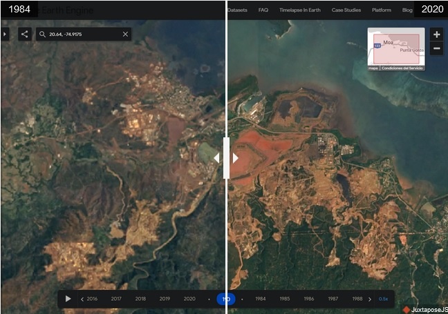
Photos over time show that reforestation is almost zero, when compared to mining areas. In the meantime, locals’ health is getting worse without them seeing the direct economic benefits of a million-dollar industry sitting in their neighborhood.
In 2019, the Sherritt International Corporation declared that there were sufficient reserves in Moa for mining ventures up until 2033.
Here is a video of how these places have changed over the past 37 years, via satellite images: