The Truth Behind Reports about US Ships Near Cuba
By Eloy Viera Cañive (El Toque)
HAVANA TIMES — Since February 5, 2026, media and political attention has intensified around the possible presence of United States military vessels in waters near the north of Cuba.
However, unlike other moments of high regional tension, the available information is fragmentary, uneven, and marked by limitations inherent to the public tracking of military assets. Even so, it is possible to reconstruct an informed picture of how many ships may have been in the area, where they were located, and what the objectives of that presence might have been, based exclusively on reports published after that date.
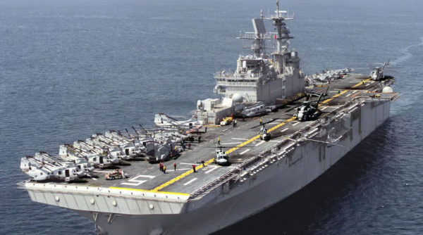
Strictly speaking, there are no official statements from the US Government or the Department of Defense confirming—by ship names and precise coordinates—the sustained presence of US military vessels “north of Cuba” after February 5. Most direct references come from digital media outlets that use public sources to conduct intelligence work (Open-Source Intelligence, OSINT) and that often rely on commercial maritime tracking tools such as VesselFinder—whose operators acknowledge significant limitations when it comes to warships, which do not always transmit AIS signals continuously or verifiably.
In independent media and on social networks, reports circulated claiming that at least three US military vessels had “appeared at dawn” very close to Cuban territorial waters on February 8. According to that information, one of the ships was detected less than eight nautical miles from the island’s northern coast, near western Cayo Romano. The reports did not identify the vessels by name or type and acknowledged that the data came exclusively from observation on commercial maritime tracking platforms, which makes it impossible to confirm with certainty the identity or mission of the observed ships.
Days later, contradictory information circulated: no US military vessels were observed in the vicinity of Cuba. The same monitoring platforms were used to support that claim. This apparent contradiction does not imply an actual withdrawal of ships but rather highlights the limits of public tracking of military vessels, especially in sensitive areas. The absence of visible signals in commercial applications does not, under any circumstances, equal a real absence of naval presence—but neither does a sighting necessarily mean a deployment intended for permanence.
Beyond that specific and unverified observation near Cuba, there is confirmed information—after February 5, 2026—of significant US naval presence in the northern Caribbean.
On February 5, 2026, the United States Embassy in Haiti announced the arrival of three military vessels in the bay of Port-au-Prince: the destroyer USS Stockdale and the Coast Guard cutters USCGC Stone and USCGC Diligence. The information was presented as part of Operation Southern Spear, framed within regional security tasks, support for stability, and maritime cooperation.
Although these vessels were not in Cuban waters nor immediately north of the archipelago, their deployment is relevant for understanding the regional context in which the observations regarding Cuba are occurring. From an operational standpoint, Haiti, Cuba, and the maritime corridors of the northern Caribbean form part of the same strategic theater for the United States—particularly with respect to controlling maritime traffic, monitoring energy routes, and enforcing international sanctions.
Several reports published after February 5, 2026, link US naval activity in the Caribbean to a broader strategy of energy pressure and maritime interdiction. On February 9, the Associated Press reported that US forces had participated in tracking and intercepting a sanctioned oil tanker, monitored from the Caribbean to the Indian Ocean. According to the report, that operation falls within what US officials describe as a policy of “oil quarantine,” aimed at cutting off Venezuelan crude export routes and preventing that oil from reaching certain markets or allies, including Cuba.
That dimension is key to understanding why the area north of Cuba acquires operational relevance. The Florida Straits and the maritime corridors connecting the Caribbean to the Atlantic constitute critical points for surveillance, tracking, and the potential interdiction of vessels linked to sanctioned energy trade. The real or potential presence of US naval assets in that area does not require a prolonged or visible stay: it may correspond to mobile, temporary deployments compatible with monitoring missions.
At the same time, other analyses published after February 5 reveal that within the US defense apparatus there is debate about the use of large warships in regional security operations in the Caribbean. Another AP report from February 9 highlighted that sectors of the Pentagon question whether interdiction missions, maritime control, and humanitarian crisis response could be carried out with smaller platforms or with a greater role for the Coast Guard. The internal debate confirms that the Caribbean is treated as an active operational space, not a secondary zone.
With the information available, it can be stated that there is no official confirmation of sustained and identified US naval presence north of Cuba. Any US naval activity near the archipelago during this period should be understood not as an exceptional or confrontational deployment, but as part of a broader strategy characterized by flexible movements, surveillance missions, and strong operational opacity.
In that context, uncertainty is not an informational failure, but rather a deliberate component of contemporary military dynamics in the northern Caribbean.
First published in Spanish by El Toque and translated and posted in English by Havana Times.