What will the 2020 Hurricane Season be like in the Atlantic?
By Yanet Diaz
HAVANA TIMES – This year’s hurricane season in the Atlantic began on June 1st, and we’ve already had three named tropical storms – two of which formed before the official start of the season. Luckily, none of these hit Cuba.
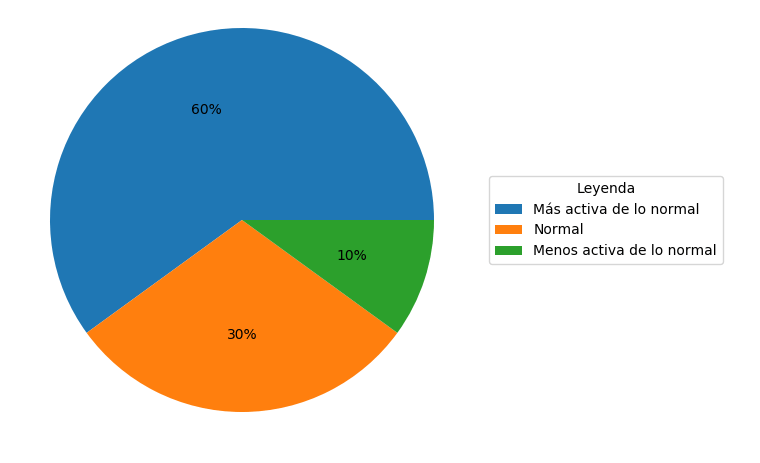
Right now, the majority of forecasts agree that the present hurricane season will be a lot more active than normal, with a 60% chance of this happening (see the Graph).
More specifically, forecasts indicate that 13 to 19 named storms are likely to take place; of which, 6-10 could turn into hurricanes, 3-6 of which could reach Categories 3, 4 and 5 on the Saffir-Simpson scale.
The following table shows these numbers and there are also comparisons with the average historical rate. As you can see, figures forecast this year are well above the average.
| Pronóstico temporada 2020 | Promedio histórico
(1981-2010) |
|
| Tormentas con nombre
(vientos de 63 km/h o superiores) |
13-19 | 12 |
| Huracanes (vientos de 120 km/h o superiores) | 6-10 | 6 |
| Grandes huracanes, categorías 3, 4 y 5 (vientos de 170 km/h o superiores) | 3-6 | 3 |
Table: Number of tropical storms and hurricanes forecast for 2020, compared to historical averages between 1981-2010.
That said, what conditions are encouraging a more active season this year? First of all, there are already early signs of La Nina developing in the region. Let’s remember that El Nino can decrease hurricane activity in the Atlantic, while La Nina intensifies and encourages it. It is worth pointing out that in previous years, when La Nina has developed, there have been very active seasons in terms of the number of hurricanes that form in the Atlantic; 2010, 2011 and 2016 were examples of this, with a total of 19,19 and 15 tropical storms, respectively.
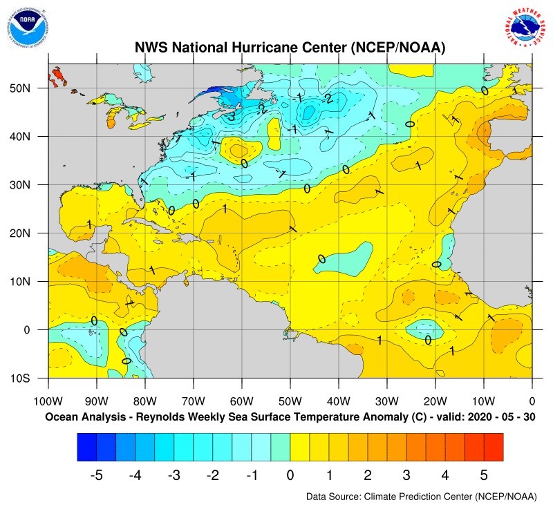
Secondly, the ocean surface temperature in the tropical Atlantic and Caribbean Sea is quite high. As you can see in the following graph, these two bodies of water show positive anomalies in temperature (yellow areas), which means that the water is warmer than it normally is at this time of year. These high temperatures represent a large amount of energy that is available for hurricanes to develop.
As a result, it is clear that we should be preparing more than ever for this hurricane season, as we only need one intense hurricane to hit Cuban soil for there to be disastrous effects.
Furthermore, the health crisis we are experiencing right now means that social distancing measures have to be respected, which could make hurricane preparation plans more complicated. Therefore, the government needs to bear this in mind when taking action in advance.