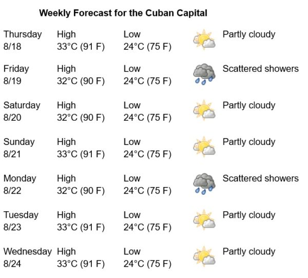
Havana Weather for August 18-24

The intense heat continues…
By Yanet Diaz
HAVANA TIMES – A tropical wave is located in the western Caribbean near the coast of Honduras and will be moving north in the coming days. As it approaches the Gulf of Mexico through the Bay of Campeche, a slight development of the system is forecast, which will take place towards the weekend. Meanwhile, in the Gulf of Mexico, high pressures prevail due to a migratory anticyclone. In the area around this anticyclone, weak winds and mostly clear skies are perceived.
This week there will be little variation in the weather. The days will be partly cloudy with a low probability of rain and an intense sensation of heat. The winds will be variable and weak in the mornings, and in the afternoons, they will be from the east and northeast, with speeds of up to 25 km/h. The humidity will range between 50 and 90%, highest at dawn. The high temperatures will be 32 and 33°C (90 and 91 F), while the lows around 24°C (75 F). The sea surface temperature will be 29°C (84 F).
Over the Gulf of Mexico, the Caribbean Sea and the Atlantic Ocean, the probability of tropical cyclone formation will remain low for the next 5 days.