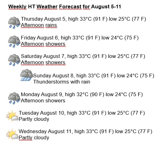
Havana Weather for August 6-12
A very warm August is expected
By Yanet Díaz

HAVANA TIMES – August begins, a month where rainfall in Cuba is slightly lower than the rest of the summer months due to the so-called “mid-summer drought.” Nonetheless, tropical troughs will be affecting the island in their transit through the Caribbean Sea and the Gulf of Mexico, causing afternoon rains.
In the Atlantic, a tropical wave is located near the western coast of the African continent, and its conditions are expected to continue to evolve to form a tropical depression by this Sunday, as the system moves west over the Atlantic. Meanwhile, over Cuba and adjacent seas, the anticyclonic influence is expected to persist, with weak winds and high temperatures.
Expect very hot days with extensive cloudiness from noon on, and some rain and storms in the afternoons, especially this Sunday, when some thunderstorms will take place that will become intense at times. No significant change is expected with the wind, which will remain from the east and northeast, with low speeds, up to 25 km/h. The humidity will range between 60 and 90%, highest at dusk. The high temperatures will be 32 and 33° C (90 and 91 F), and the lows 24 and 25° C (75 and 77 F). The sea surface temperature will be 29° C (84 F).
On the North Atlantic, the Gulf of Mexico and the Caribbean Sea the probability of tropical storm development will be between medium and high during the next 5 days.