The Cuban Weather Service on Hurricane Isaias
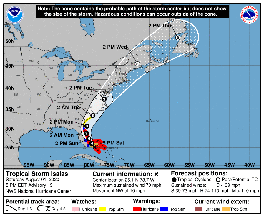
HAVANA TIMES – As it moves further from Cuba, Hurricane Isaías has continued its displacement to the northwest, making landfall on the north of Andros Island, in the northern Bahamas, reported the Cuban Weather Service INSMET at noon on Saturday.
This interaction with land and winds in the upper levels of the troposphere produced a slight weakening on Saturday morning. Its maximum sustained winds decreased to 125 kilometers per hour, with higher gusts and the central pressure at 993 millibars (at 5:00 p.m. ET).
Isaías is just below a category one hurricane on the Saffir-Simpson scale of a maximum of five and is expected to regain that status later tonight.
At noon today, its center was estimated by INSMET at 24.8 degrees North latitude and 78.0 degrees West longitude, a position that placed it about 255 kilometers southeast of Miami, Florida. It continues to move northwest at 19 kilometers per hour.
Although it is slowly moving away from Cuba, part of its external bands produced heavy rains during Friday night and early Saturday in the province of Santiago de Cuba, especially in mountainous areas.
The most significant rainfall in the 24 hours until 8:00 in the morning Saturday were: 169.3 millimeters, recorded at the Las Coloradas Hydrometric Station; 149.3 millimeters, at the Gran Piedra Weather Station; 116.8 millimeters at Gilbert Reservoir, and 115.3 millimeters at the Aguas Turquino Company.
Today some bands of clouds will still persist over Cuba with rains, showers and some thunderstorms in the central and eastern provinces, which can be strong in some localities, mainly in mountainous areas. In the west, showers and rains can occur at intervals, mainly in areas of the north coast.
In the next 12 to 24 hours Isaías is predicted to remain on its same course, with little change in its movement speed and fluctuations in his intensity, as it continues hitting the northern group of the Bahamas and approaching the Florida peninsula.