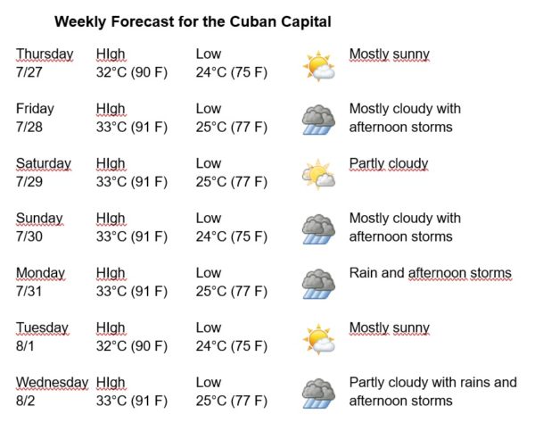
Havana Weather for July 27 to August 2
Northeasterly winds and afternoon showers…
By Adrian Fuentes
HAVANA TIMES – During the last hours some rains were reported in the western region of Cuba, being locally strong in areas of the capital. These precipitations were encouraged by the instability generated by an upper low over the western Caribbean Sea in combination with an increase in humidity in the lower layers and favorable local conditions.
Winds during the next week are expected mainly from the northeast, with speeds between 15 and 25 km/h. The relative humidity will rante between 80% and 100%. The high temperatures will be at 32 and 33ºC (90 and 91 F) and the lows at 24 and 25ºC (75 and 77 F). The sea surface temperature will be 30ºC (86 F).
An active tropical wave is located to the southeast of the Cape Verde Islands, it is currently associated with abundant areas of disorganized storms, the environment is not entirely favorable for a tropical cyclonic development, however, as it moves west-northwest over the eastern tropical Atlantic Ocean some cyclonic development is possible during the coming days.
An upper level low near the western tip of Cuba is inducing scattered showers and isolated thunderstorms over much of Havana, while the subtropical ridge maintains a pattern of trade winds reinforced by a robust tropical wave, with moderate ENE winds to the ESE, which are locally strong. For the forecast, the tropical wave will continue to produce fresh to locally strong winds, showers and thunderstorms over the western part through Thursday. In the rest of the area of the Atlantic Ocean, the Caribbean Sea and the Gulf of Mexico, tropical cyclone development is not expected in the next 12 to 24 hours.