Cuba’s Varadero Channel
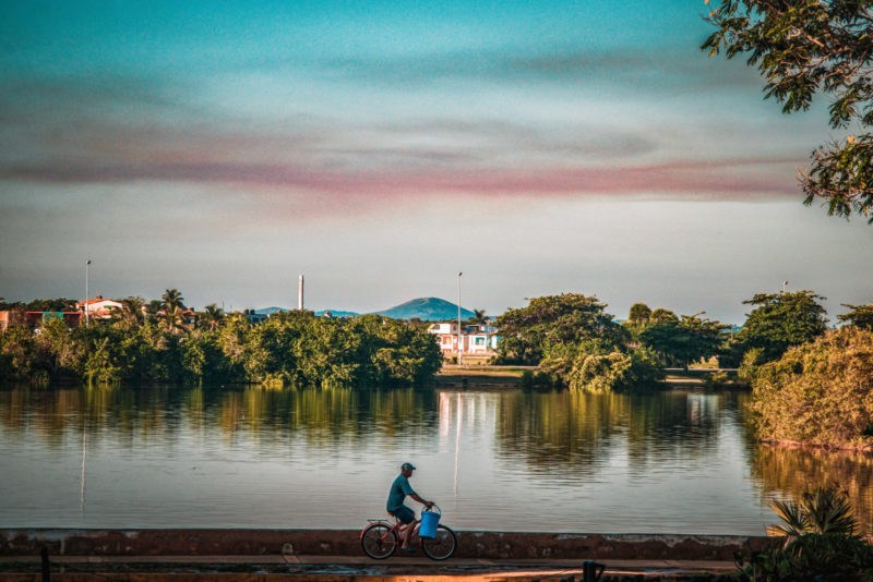
Photo Feature by Idania Cardenas
HAVANA TIMES – In its beginnings, Varadero¸ today Cuba’s leading tourist resort area, was a fairly isolated place, so isolated that it could only be reached from Cardenas by road or on horseback. With the boom of the 1940s and 1950s, it became essential to improve the road access, as well as a process of resuscitation and urban development in tune with the demands of national and foreign visitors.
In 1942, dredging began for the construction of a channel that would connect the Paso Malo lagoon with the northern channel. As a complement to the sanitation and rehabilitation works of said lagoon, the canal would link the aforementioned lagoon with the Bay of Cardenas.
The total channel would be 5.1 km long, 40 meters wide and 15 feet deep. It would reduce the distance between Cardenas and Varadero by 22 km. By land, communication would be established by means of a drawbridge that would connect with the Via Blanca road.
The Canal crosses the peninsula from north to south and separates it from Santa Marta. On the inner shore it is bordered by a sidewalk that allows you to sit down to fish and take photos of the sunrise or sunset. At dawn the tide rises, and some incredible water mirrors are formed.


and has the drawbridge ever worked?